Yesterday I was able to work towards my Terrain 1 permit for Scouts. The first part was walking on South Barrule in dense fog (where we literally were navigating by compass alone because sight was almost impossible) whereas yesterday was lovely weather offering wide vista of the Manx landscape from the mountain.
During this, we were fortunate to be accompanying experienced leaders who were happy to impart their tips of the trade, many of which are here.
Know your location
Probably most important amongst equals is that you always need to know where you are on the map, but don’t necessarily trust it.
- Mark off where you’ve been on the map to help your eyes get to your current location quicker, allowing you to find your current location easier.
- Look at your map, don’t glance at it.
- The map is out of date as soon as it is printed, so make sure you keep up to date with the various maps available in the area and use your eyes to see how the landscape actually is.
- Look out for landmarks, “collecting” them, and marking them off on your map. In the event of trouble, you can use these to track your progress if you need to turn back and reassure you that all is in hand.
Know your pace
As much as it is important to know where you are and where you want to be, you should also have an idea of how long it will take to get there.
- Use pacing to see how many paces per 100 metres. Everyone’s pace will be different. A “pace” can be Left-foot then right-foot, so an adult can expect to get around 50-65 paces per 100 metres.
- Your can then use this, in conjunction with the Romer scales on your compass to guage distances on the map, to get an idea of when you should expect to get there.
For example, if I know there is a visible landmark such as a monument in about 250 metres, and I walk 100m every 2 minutes at a speed of 3km/h, I’d expect to have got to the monument in about 5 minutes (2 * 100 plus a bit). If I haven’t got there in that time, then something is wrong and I’ve caught it before it got too late. This isn’t an exact science and doesn’t take into account of chatting within the group, navigating around tricky ground or “look at that” moments, but a rough timing chart is:
| Distance (m) | Time over 2km/h (mins) | Time over 3km/h (mins) | Time over 4km/h (mins) | Time over 5km/h (mins) | Time over 6km/h (mins) |
|---|---|---|---|---|---|
| 1,000 | 30 | 20 | 15 | 12 | 10 |
| 900 | 27 | 18 | 13.5 | 10.8 | 9 |
| 800 | 24 | 16 | 12 | 9.6 | 8 |
| 700 | 21 | 14 | 10.5 | 8.4 | 7 |
| 600 | 18 | 12 | 9 | 7.2 | 6 |
| 500 | 15 | 10 | 7.5 | 6 | 5 |
| 400 | 12 | 8 | 6 | 4.8 | 4 |
| 300 | 9 | 6 | 4.5 | 3.6 | 3 |
| 200 | 6 | 4 | 3 | 2.4 | 2 |
| 100 | 2 | 2 | 1.5 | 1.2 | 1 |
You should add extra for known causes of slowing your pace, for example, ascending.
Everything Outdoors has handy pacing charts with guides on adding for ascents, etc.
Use different maps
Maps have a wealth of information on them, but not all at the same depth or quality.
- Use at least two maps, each at a differing scale (one should be 1:25000). Each map will show different levels of detail. Closer scales may give more detail as to the type of landscape features (eg. church towers/spires), wider scales are useful for wider views of an area and may include additional detail.
- Consider public/private land boundaries in walks. Some maps distinguish between these types of land and therefore indicate where you can roam freely.
Consider the weather
It goes without saying not to head out of the weather isn’t looking too good, but seasonal changability can have impact mid-journey.
- Water-courses on your map may not be evident in the summer or be too strong or deep to safely cross in the winter. Look for vegetation changes where water courses should be (longer grass).
- In the event of low visibility, which can occur quickly particularly on high ground, you may need to rely on your compass. Take a bearing from your map to a landmark fairly close by and head towards that bearing, repeating until your final destination or until visibility improves.
Don’t rely on technology
Modern smartphones are awesome in what they can do. With a good app, they can give you maps, calculate stats, check your fitness and more. But they are also susceptible to power loss, getting damaged or even not being able to see your screen because of the sun’s glare on the screen.
- Know how to use a map and compass, using your technology to reinforce.
- You cannot assume you will get an accurate GPS signal, which may be restricted by trees, other transmissions in the same frequency or metallic surfaces.
- Use a fully-charged Powerbank or other portable battery should you find your device(s) out of power. It’s an almost permanent item in my rucksack – that and a load of USB cables!
It is a common and upward trend that people get into trouble because they rely on their technology alone – and then try to use it to summon the help they need.
Safety
Hiking is inherently risky, and it is easy to turn your ankle or worse. Therefore safety and risk must be considered.
- Try not to go alone, in case you need assistance.
- Tell people where you’re going and when/where to expect you back. As soon as you fail to meet that time, emergency help should be sought.
- At any given point on the route, you may need to abort. Being close to an exit point which may be accessible to an ambulance is ideal but being able to get to one would be imperative.
- You can’t determine an exit point from a map alone. There may be a road close by, but structures may be in place that may impede accessibility. In some cirumstances it may be easier to go back the way you came, it may be longer but you know the route and risks.
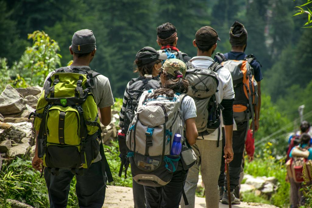
Groups
More responsibilities are evident when walking in a group, such as a Scout Troop.
- Keep the group together. If there are leaders, place one in front of the group to control the pace and one behind to encourage stragglers.
- The front and back of the group must be in visual and auditory contact. Leading people should consider pausing at brows of hills to allow others to catch-up and maintain this contact.
- If possible, do a reconnaissance of the route beforehand so you’re aware of any differences in the route and the map.
These are just some of the tips I gathered yesterday and so far in general hiking. If you have any to share, please do so in the comments.

Leave a comment